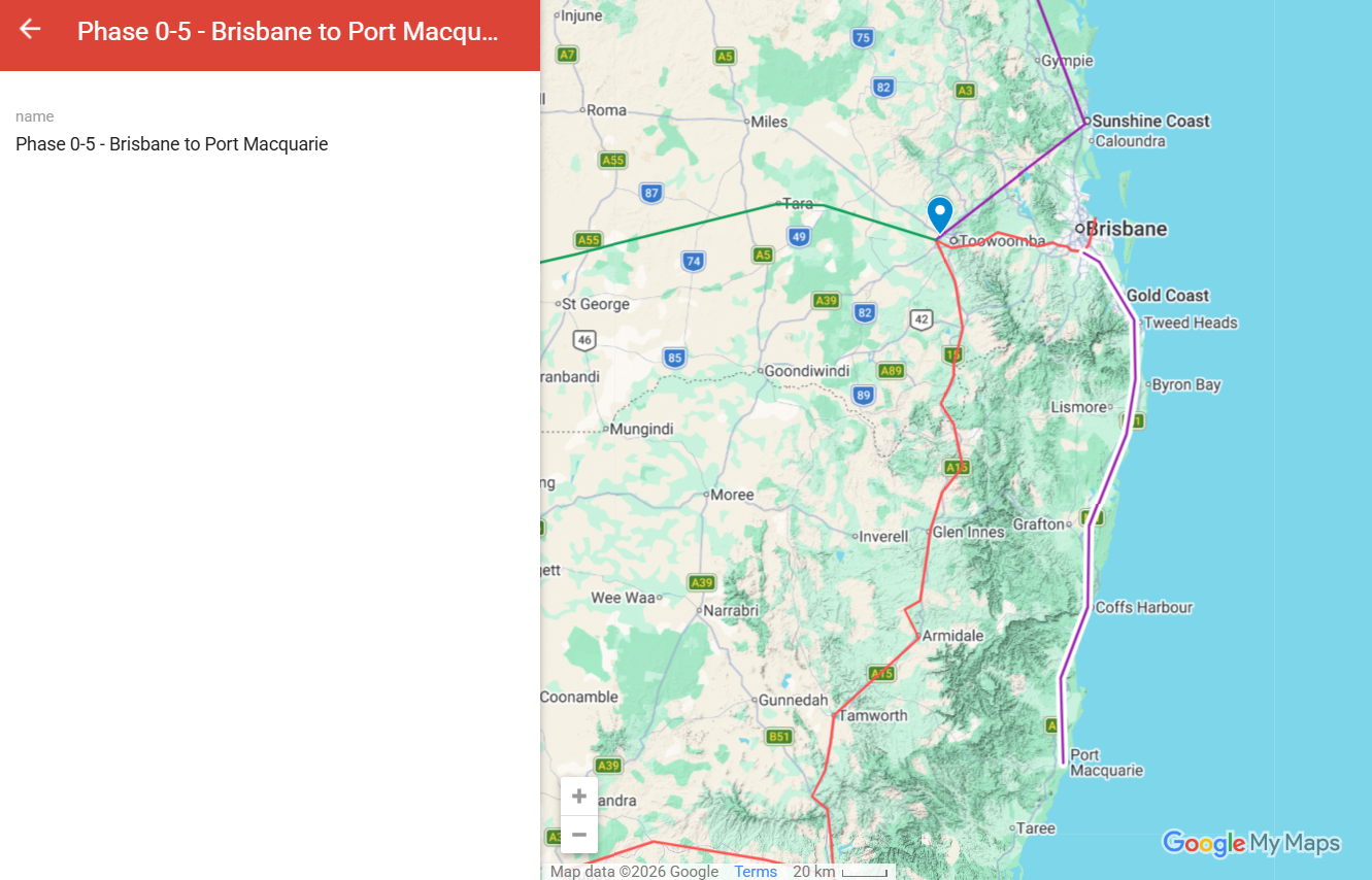
A coastal NSW corridor connecting Brisbane to Port Macquarie via the mid-north coast. Removes B-double freight traffic from the Pacific Highway through Coffs Harbour, Grafton, and Lismore.
For you
What this route does for you.
This section will describe what the route specifically delivers for the people on or near the line — journeys enabled, towns connected, what changes for everyday life. Audience-specific framing in development.
The route
Where it goes.
Plain-language route description in development. Will describe the corridor alignment, terrain, length, and key engineering features.
Communities on the line
Towns and stations along the corridor.
List of communities along the corridor and what each town gains from the connection — in development.
Direct journey time
If you board and stay on.
Journey
Distance
Maglev
Electric freight
Brisbane → Port Macquarie
447 km
45min
1h 50min
Direct point-to-point time. Maglev at peak speed, electric freight at peak. No intermediate stops.
What it carries
Services on the corridor.
Service stack carried by this corridor (passenger maglev, electric freight, HVDC transmission, water, gas, fibre, etc.) — detail in development.
When it gets built
Timing.
Sequencing open. The order of phases beyond Phase 0 will be determined by political and economic momentum, capital partner sequencing, and community advocacy after the Phase 0 spine is operating.
Design and engineering
How this route gets built.
Design and engineering detail — pylon configuration, viaduct type, terrain treatment, construction methodology, manufacturing approach. To be developed alongside the dedicated MMC engineering memo for this route.
Phase 0-5 engineering diagram — image to be added
Costs and funding
What this route costs.
Cost build-up and funding plan — capital, operating, lifecycle. Detailed cost engineering memo in preparation. Numbers will be published once the analysis is complete and reviewed.
Engineering memo
Read the technical study.
A dedicated engineering memo studying this route — alignment analysis, terrain data, traffic projections, cost build-up — is being developed for publication on the Multi-Modal Corridors site. Link will be added when the memo is complete.
One programme. The whole nation, built together.
Read the full plan, see the benefits, and find out how to take action.