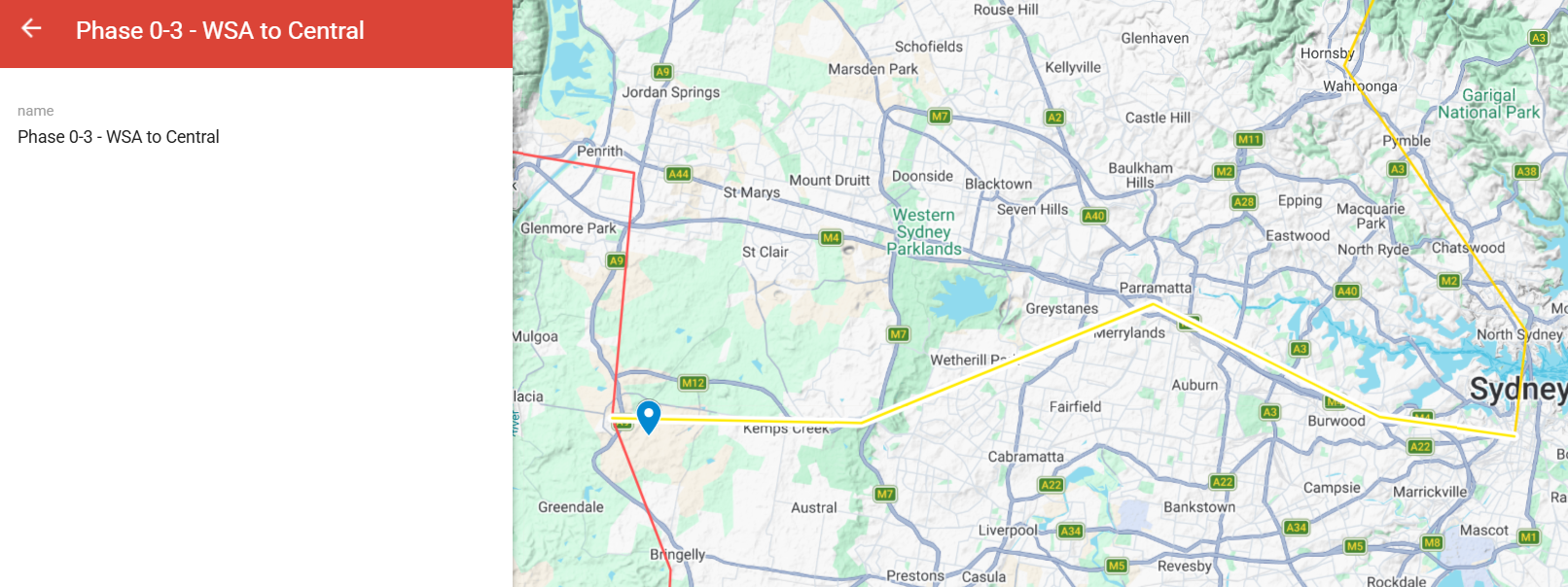
Extending the Phase 0 spine 50 km from Western Sydney Airport directly into Sydney Central. The new international airport — currently disconnected from the rest of Sydney by anything except road — finally gets a real continental rail connection.
For you
What this route does for you.
This section will describe what the route specifically delivers for the people on or near the line — journeys enabled, towns connected, what changes for everyday life. Audience-specific framing in development.
The route
Where it goes.
Phase 0-3 runs 50 km from Western Sydney Airport east into Sydney Central. The corridor connects the new airport directly to the Sydney CBD and to the Phase 0 spine, enabling continental travellers to reach Sydney CBD in minutes rather than hours via the M5/M7 road network.
Direct journey time
If you board and stay on.
Journey
Distance
Maglev
WSA → Sydney Central
50 km
6min
Passenger-priority corridor — maglev only. Direct point-to-point time at peak speed. No intermediate stops. Freight stays on the Phase 0 spine.
Communities on the line
Towns and stations along the corridor.
Stations: Western Sydney Airport, Liverpool, Bankstown, Sydney Central. Connects the south-western and inner Sydney corridor to the new airport and through it to the rest of the continental network.
What it carries
Services on the corridor.
Passenger maglev priority configuration. Integrates with the Phase 0 spine at WSA.
When it gets built
Timing.
Sequencing open. The order of phases beyond Phase 0 will be determined by political and economic momentum, capital partner sequencing, and community advocacy after the Phase 0 spine is operating.
Design and engineering
How this route gets built.
Design and engineering detail — pylon configuration, viaduct type, terrain treatment, construction methodology, manufacturing approach. To be developed alongside the dedicated MMC engineering memo for this route.
Phase 0-3 engineering diagram — image to be added
Costs and funding
What this route costs.
Cost build-up and funding plan — capital, operating, lifecycle. Detailed cost engineering memo in preparation. Numbers will be published once the analysis is complete and reviewed.
Engineering memo
Read the technical study.
A dedicated engineering memo studying this route — alignment analysis, terrain data, traffic projections, cost build-up — is being developed for publication on the Multi-Modal Corridors site. Link will be added when the memo is complete.
One programme. The whole nation, built together.
Read the full plan, see the benefits, and find out how to take action.